 |
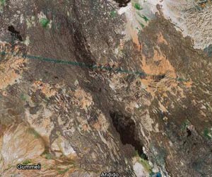
Singapore (AFP) March 31, 2011 Google on Thursday revealed that an army of citizen cartographers is behind its widely used mapping service, helping the Internet search giant chart the world, including often inaccessible places. Volunteers from various countries post updates on their neighbourhoods or travel to remote places to map the area before uploading their findings to Google Map Maker, the company said at a conference in Singapore. Contributors can add new roads and landmarks or debate with neighbours about the names of streets on the virtual map, which is constantly updated with new information. Google Map Maker allows people to add or edit features, such as roads, businesses, parks and schools, and give detailed information about the locations. "You are now the mapping agency of the world, and many of the mapping agencies are recognising that fact," Google's geospatial technologist Ed Parsons said at the Google Geo Community Summit attended by contributors from different countries. "The large, top-down approaches to making maps that traditionally the industry has followed for many thousands of years are changing very rapidly," he added. "They now go from a bottom-up approach, where local experts, people like yourselves are making maps, they are updating the maps, because you are the experts in your local neighbourhoods." Parsons said Google maps have been used extensively to help relief efforts during natural disasters such as in the recent earthquake and tsunami that struck northeastern Japan on March 11. Indian retiree CNR Nair spends about two hours daily updating mapping information on India. He travels to different places, and even checks if the latitudes tally from the ones on Google Map Maker. But mapping out his homeland has not been entirely smooth sailing for Nair. Working without government approval, he initially met resistance from the local police who threatened to arrest him. "Google Maps should serve the community," he told AFP. "During the Indian (Ocean) tsunami, we mapped all these tsunami affected areas so that in the future at least people should be aware to get (people) evacuated from the possible tsunami affected areas or flood areas." Other volunteers have travelled from Moscow to Siberia by rail, filming the entire journey from the train window and uploading it onto Google Map Maker, the conference heard.
Share This Article With Planet Earth
Related Links Earth Observation News - Suppiliers, Technology and Application
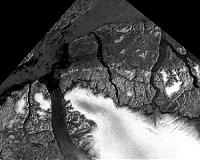 Measurements Of Winter Arctic Sea Ice Shows Continuing Ice Loss
Boulder CO (SPX) Mar 25, 2011 The 2011 Arctic sea ice extent maximum that marks the beginning of the melt season appears to be tied for the lowest ever measured by satellites, say scientists at the University of Colorado Boulder's National Snow and Ice Data Center. The CU-Boulder research team believes the lowest annual maximum ice extent of 5,650,000 square miles occurred on March 7. The maximum ice extent was 463,000 ... read more |
|
| The content herein, unless otherwise known to be public domain, are Copyright 1995-2010 - SpaceDaily. AFP and UPI Wire Stories are copyright Agence France-Presse and United Press International. ESA Portal Reports are copyright European Space Agency. All NASA sourced material is public domain. Additional copyrights may apply in whole or part to other bona fide parties. Advertising does not imply endorsement,agreement or approval of any opinions, statements or information provided by SpaceDaily on any Web page published or hosted by SpaceDaily. Privacy Statement |

 del.icio.us
 Digg
Digg Reddit
 YahooMyWeb
 Google