| . |  |
. |
|
|
. |
by Katie Neith for Caltech Pasadena CA (SPX) Aug 12, 2011
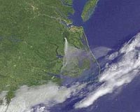
Like scars that remain on the skin long after a wound has healed, earthquake fault lines can be traced on Earth's surface long after their initial rupture. Typically, this line of intersection between the area where the fault slips and the ground is more complicated at the surface than at depth. But a new study of the April 4, 2010, El Mayor-Cucapah earthquake in Mexico reveals a reversal of this trend. While the fault involved in the event appeared to be superficially straight, the fault zone is warped and complicated at depth. The study-led by researchers at the California Institute of Technology (Caltech) and documenting findings from the magnitude 7.2 event, which was centered in the Baja California state of Mexico-is available online in the journal Nature Geoscience. The El Mayor-Cucapah earthquake happened along a system of faults that run from Southern California into Mexico, cutting through the Cucapah mountain range and across the Colorado River delta. This system of faults forms a portion of the plate boundary between the Pacific Plate and the North American Plate. Two main segments of the fault tilt downward steeply from the surface at opposing angles: the northwestern half angles downward beneath the Mexicali Valley, whereas the southeastern half angles away from the valley. In a standard model, transform plate boundary structures-where two plates slide past one another-tend to be vertically oriented, which allows for lateral side-by-side shear fault motion. In the case of this quake, however, lead author Shengji Wei, a postdoctoral scholar in geophysics, and colleagues showed that the 120-kilometer-long rupture involved angled, non-vertical faults and that the event was initiated on a connecting extension fault between the two segments. "Although the surface trace is nearly linear, we found that the event, which started with a smaller quake, happened mainly on two faults with opposite dipping directions," says Wei. In fact, the seismic rupture traveled through a relatively complicated set of preexisting faults that are dipping in various directions. "It was really surprising to see a straight fault trace that cuts through the Colorado delta and the rugged topography of the Sierra Cucapah as a result of this event," says Jean-Philippe Avouac, director of Caltech's Tectonics Observatory and principal investigator on the study. The team used interferometric synthetic aperture radar (InSAR) and optical images gathered from satellites, global positioning system (GPS) data, and seismological data to study the rupture process. By combining the GPS data and remote sensing techniques-which provide measurements of surface displacement-and seismological techniques to study the ground vibrations generated by the temblor, the researchers were able to produce an extremely well-resolved model of the earthquake. The model describes the geometry of the faults that broke during the quake and the time evolution of the rupture. It shows that once the earthquake began with an extensional deep break that pulled the two segments apart, it spread bilaterally to the northwest and the southeast. As the rupture spread northwestward, it continued to break erratically through the faults below the Cucapah mountain range. Simultaneously, the rupture spread towards the southeast, breaking a fault that had been covered over by a blanket of sediments that forms the Colorado River delta. "High-resolution satellite radar images allowed us to locate a previously unmapped fault-the Indiviso Fault-beneath the Colorado River Delta that had been buried by river sediments since its last earthquake," says NASA's Jet Propulsion Laboratory (JPL) geophysicist Eric Fielding, who was a coauthor of the study. "This fault moved up to 16 feet, or 5 meters, in the April 4, 2010, earthquake." Wei says that since the new analysis indicates the responsible fault is more segmented deep down than its straight surface trace suggests, the evolution and extent of this earthquake's rupture could not have been accurately anticipated from the surface geology alone. Anticipating the characteristics of an earthquake that would likely happen on a young fault system (like the event in the study) is a challenge, since the geologic structures involved in the new fault system are not clear enough. According to Avouac, the data can also be used to illustrate the process by which the plate boundary-which separates the Pacific Plate from North America- evolves and starts connecting the Gulf of California to the Elsinore fault in Southern California. "We may have to wait for a couple of million years to clearly see the active fault zone in the topography, as we can now see further north in Central California, for example," Avouac says. "Earthquakes with magnitude 7.5 and lower are probably typical of this kind of younger fault zone, while fault zones with a longer geological history and simpler fault geometries are more prone to produce larger ruptures." This is important information, since damage estimates from the earthquake, which mostly affected agribusinesses, topped $440 million in the Mexicali Valley of Baja California and $90 million in the Imperial Valley of California. The paper, "Superficial simplicity of the 2010 El Mayor-Cucapah earthquake of Baja California in Mexico," appeared as an advanced online publication on July 31 in the journal Nature Geoscience. Sebastien Leprince, Anthony Sladen, Don Helmberger, Egill Hauksson, Risheng Chu, and Mark Simons, all from the Division of Geological and Planetary Sciences at Caltech; Kenneth Hudnut, geophysicist at the United States Geological Survey (USGS) in Pasadena; Thomas Herring, professor of geophysics at MIT; and Richard Briggs, research geologist at USGS in Golden, Colorado, also contributed to the study, which was funded by the National Science Foundation, USGS, the Gordon and Betty Moore Foundation, NASA and the Southern California Earthquake Center.
|
. |
|
| The content herein, unless otherwise known to be public domain, are Copyright 1995-2011 - Space Media Network. AFP and UPI Wire Stories are copyright Agence France-Presse and United Press International. ESA Portal Reports are copyright European Space Agency. All NASA sourced material is public domain. Additional copyrights may apply in whole or part to other bona fide parties. Advertising does not imply endorsement,agreement or approval of any opinions, statements or information provided by Space Media Network on any Web page published or hosted by Space Media Network. Privacy Statement |

 del.icio.us
 Digg
Digg Reddit
 Google